IN Brief:
- The Ministry of Defence intends to award the University of Bristol a £368,512.48 research contract excluding VAT.
- The proposed two-year work covers autonomous radiation mapping, source localisation, threat characterisation and validation trials.
- A future signature date of 6 November 2026 means the contract has not yet been confirmed as signed.
The Ministry of Defence intends to award the University of Bristol a £368,512 research contract covering autonomous radiation mapping by uncrewed aircraft. The procurement notice, published on 15 October 2026, identifies work on algorithms, radiation-source localisation, threat characterisation and validation trials. It is a planned direct award, with contract signature scheduled for 6 November, rather than an agreement already signed.
The proposed two-year contract has an exact value of £368,512.48 excluding VAT, or £442,214.98 including VAT, with a scheduled term from 6 November 2026 to 6 November 2028. The named supplier is the University of Bristol, and the requirement concerns postdoctoral research and knowledge transfer alongside technical development. There is no announced production system, deployable aircraft order or operational acceptance milestone.
The ministry proposes a single-supplier route because the work continues an existing autonomy research programme led by Bristol. The procurement record cites the university’s accumulated intellectual property, datasets, methods and specialist knowledge as the justification for a direct award. The next phase is therefore intended to mature existing research rather than select an entirely new sensing system through an open competition. Neither a final sensor configuration nor a named military end user is specified.
An airborne radiation survey associates measurements from a detector with the aircraft’s recorded position, altitude and time. Readings gathered along the flight path can be combined into a map of measured intensity and, where suitable spectroscopy is available, the distribution of particular gamma-ray energies. The signal depends on the distance to a source and can be affected by background radiation, terrain, shielding and detector sensitivity. A detector also needs sufficient measurement time to accumulate statistically useful counts; short passes over an area may leave substantial uncertainty even when the aircraft position is accurately known. A reconstructed radiation map therefore depends on the flight geometry and quality of the measurements, rather than revealing every source directly.
Localising a source autonomously requires a UAV to choose where to measure next. Rather than simply following pre-programmed waypoints, an aircraft may need to decide which additional measurements would best distinguish a concentrated source from diffuse contamination or reduce uncertainty in its estimated position. Such decisions require sensor processing to interact with flight planning while respecting aircraft endurance and operating constraints. The planned research will examine and validate these functions, but the notice supplies neither a chosen algorithm nor any achieved detection rate, mapping accuracy or localisation error.
University of Bristol researchers have previously used small uncrewed aircraft for gamma-ray mapping around Sellafield and in areas affected by the Fukushima and Chernobyl accidents. Work in Japan included low-altitude surveys using lightweight gamma-ray spectrometers, with data associated with flight positions to support more localised contamination assessment. These earlier demonstrations provide a basis for further algorithm development; they are not test results from the proposed MoD research period.
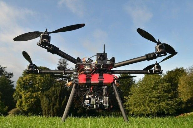
During its 2019 Chernobyl work, Bristol used different aircraft approaches, including rotary-wing and fixed-wing platforms, and investigated gamma and neutron measurements. Rotary-wing aircraft can hover and revisit a small area precisely, whereas fixed-wing aircraft can generally cover larger areas efficiently but have different launch, recovery and manoeuvring constraints. Payload mass, battery endurance, positioning error and the detector’s counting statistics all affect how much reliable survey information can be collected on a flight.
Trials would need to compare survey estimates with independently characterised sources or reference measurements. Localisation error, repeatability, false detections and stability under changes in flight altitude are potential assessment measures; the published notice does not specify which thresholds will be used. Reference measurements also allow a research team to assess whether an apparent change reflects sensor behaviour, a different flight trajectory or a genuine difference in the area being surveyed. It would be premature to claim improved sensitivity, faster response or longer flight endurance before controlled measurements from this next phase have been released.
Remote radiation surveys can support reconnaissance of contaminated sites and initial assessment after radiological incidents without requiring personnel to enter every potentially affected area. An aircraft still requires safe operating conditions and a controlled flight plan, while interpreting the data may call for information beyond gross radiation intensity. A high detector count does not automatically identify a particular radionuclide or explain the source’s location, so sensor choice, calibration and subsequent analytical work remain important.
Contract signature is scheduled for 6 November, with research continuing until November 2028 if the proposed agreement proceeds. Laboratory assessment and field validation should establish the practical limits of the algorithms before any decision about integration with operational aircraft. No procurement for such a deployed system has been announced.